
White Bear Lake Street Trail
For a current address question, the useful White Bear Lake street directory sequence is address, parcel, legal description, land document, then a carefully limited voter or historical source. The Ramsey County Property Tax and Value Lookup identifies the parcel record. MapRamsey shows how that parcel sits among nearby lots. RecordEASE ties the parcel's legal description to recorded transfers. A street name alone is weak evidence because postal, municipal, township, and historic names can differ. Keep the number, direction, suffix, unit, parcel identification number, and site address together while comparing results.
- Enter the complete site address in the Ramsey County property search and select the matching parcel. Save the PIN, site address, owner fields, and legal description shown for that parcel.
- Open the same address in MapRamsey. Check the parcel polygon, then click nearby polygons only to understand the street segment and compare the displayed site fields.
- Use the PIN or legal description in RecordEASE to find a title-transfer document. Record the document number, recorded date, grantor, grantee, land type, and legal description.
- For a lawful voter question, use the separate Minnesota list-request route. MNVotes is a confirmation form, not a way to browse a street.
- When the address is old, test the historic street name and the White Bear Lake old-to-new address cross-reference before checking permits, newspapers, plats, or historical directories.
That order avoids a common error: treating the current tax owner or a mailing address as the complete answer to who is at an address. The parcel gives the durable key. The deed explains a title transfer. Dated local sources can then help with a past address question.
White Bear Lake Beacon Fields
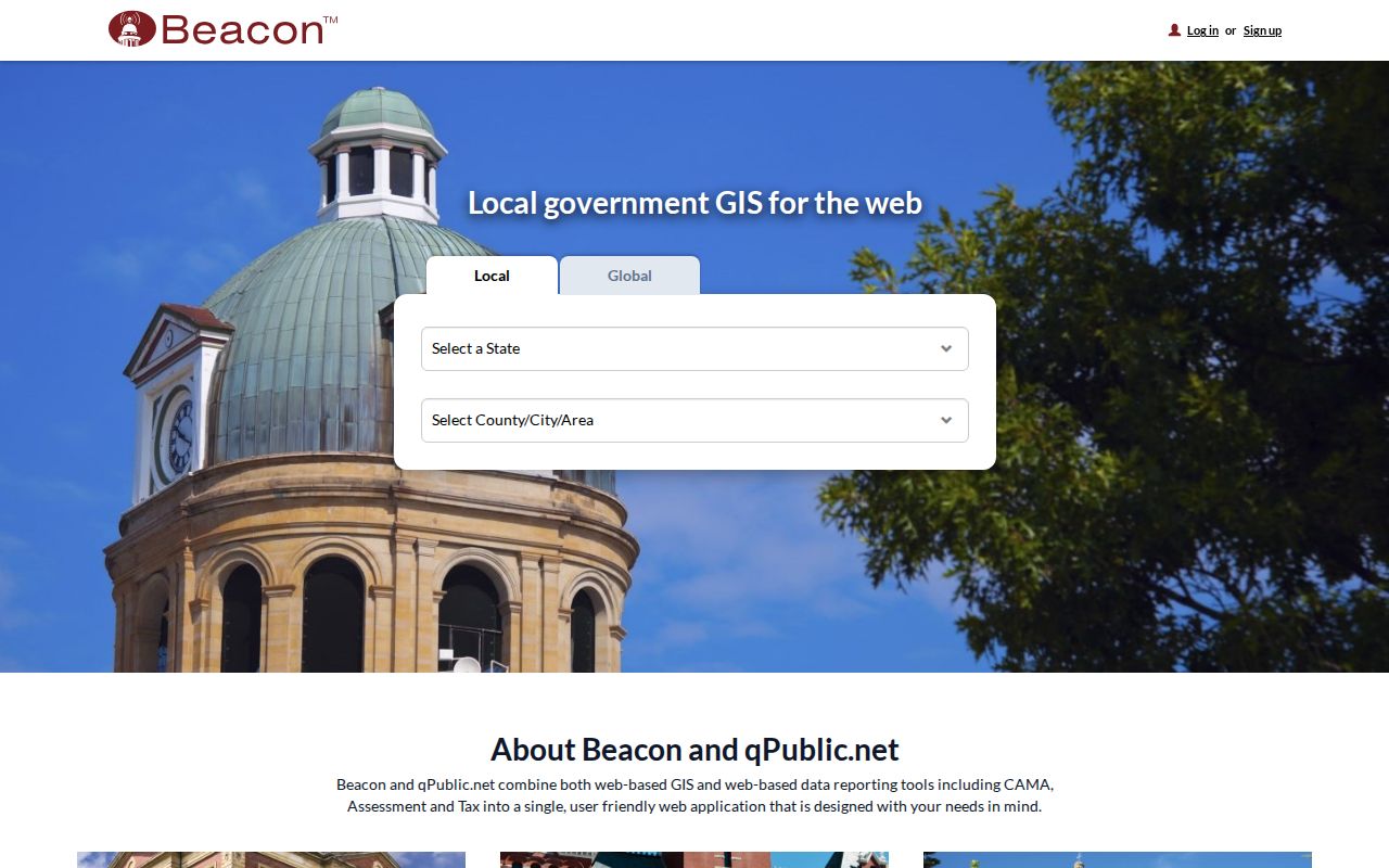
Ramsey County Property Tax and Value Lookup leads to the Beacon property application. It is a parcel and value tool, so its best use in a street directory search is to anchor an address to the county's record rather than to identify every person at that address. County guidance directs searchers to choose the parcel under Property Search Results before using the payment link. Try spelling and initial variants if an owner-name search is needed, and keep a number-specific address search as the primary method.
| Search field | Input | Required | White Bear Lake use |
|---|---|---|---|
| Site address | Text or address selection | No | Best first field for a numbered street location. |
| Owner last name | Text | No | Test spelling and initials after the parcel is identified. |
| Parcel or PIN | Text | No | Carry the county parcel identifier into map and deed work. |
| City | Text or selection | No | Use White Bear Lake, then compare any city variant on the parcel. |
| ZIP or map | Text filter or map selection | No | Compare site ZIP with owner or tax ZIP instead of assuming they match. |
The Beacon search interface is shown in the county's property-search screenshot below. Its live controls are JavaScript-driven, so field labels and available choices should be checked in the active application before relying on them for a new search.
Use the result to select one parcel, not to turn a street-wide list into a household roster. The property record is strongest when its site address, PIN, and legal description agree.
Note: A parcel result identifies property records and owner fields, but it does not establish that every person connected with the address lives there.
White Bear Lake Owner Fields
A White Bear Lake street directory needs four separate ideas kept apart. Ramsey's ArcGIS owner layer has owner-name fields, owner mailing fields, tax-name and tax-address fields, homestead fields, and site-address fields. A site or situs address is the physical parcel location. A mailing address tells the county where correspondence goes. A tax address can belong to a representative. Homestead data is a classification clue that may support an owner-occupancy inference, but it is not a count of the people living in the home.
- Parcel
- A defined piece of land in the county system, identified by a PIN and geometry. It is the link between a street address and land records.
- Situs address
- The physical site address for the parcel. It can differ from the owner's mailing or tax address.
- Plat
- A recorded map that lays out a subdivision, addition, lots, blocks, streets, or easements. It can clarify an older address search.
- Criss-cross directory
- A reverse address directory, when a volume includes one, that can connect a street address to a dated listing.
White Bear Lake also sits in a records geography that needs care. The incorporated city is in Ramsey County, but nearby White Bear Lake-area places and some local geography touch Washington County. Confirm the county from the parcel and legal municipal fields, not just from a mailing city or a ZIP code.
White Bear Lake MapRamsey Parcels
MapRamsey is the practical tool for walking the White Bear Lake street segment around a known address. Its public layers include tax parcels, property details, classifications, valuation, current and historic aerials, oblique views, environmental data, administrative boundaries, and points of interest. Search or zoom to the address, select the target polygon, and note the displayed parcel information. Then pan along the street and select other polygons one at a time. Parcel boundaries are more useful than a building outline for determining which legal parcel a record belongs to.
MapRamsey is a convenience viewer, not an official boundary survey or title opinion. The map may display an owner, mailing, tax, homestead, site, ZIP, construction-year, and edit-date field, but each field answers a different question. A polygon selected on the map should be matched back to the property search and then to RecordEASE through a PIN or legal description. If those records disagree, preserve the conflict and ask the appropriate county office rather than choosing the most convenient result.
Note: Historic aerials and boundary layers give street context, while the recorded plat, survey, or title record controls a precise boundary question.
White Bear Lake Deed Records
The Ramsey RecordEASE Web portal is the next step after the parcel is frozen. Ramsey maintains both Abstract and Torrens land. An Abstract parcel follows the recorded-document chain. Torrens land is registered through a court and Examiner of Titles process, with a certificate of title that names the owner, land description, and recorded interests. The legal description, rather than a street label, is the bridge between the assessed parcel and the recorder index.
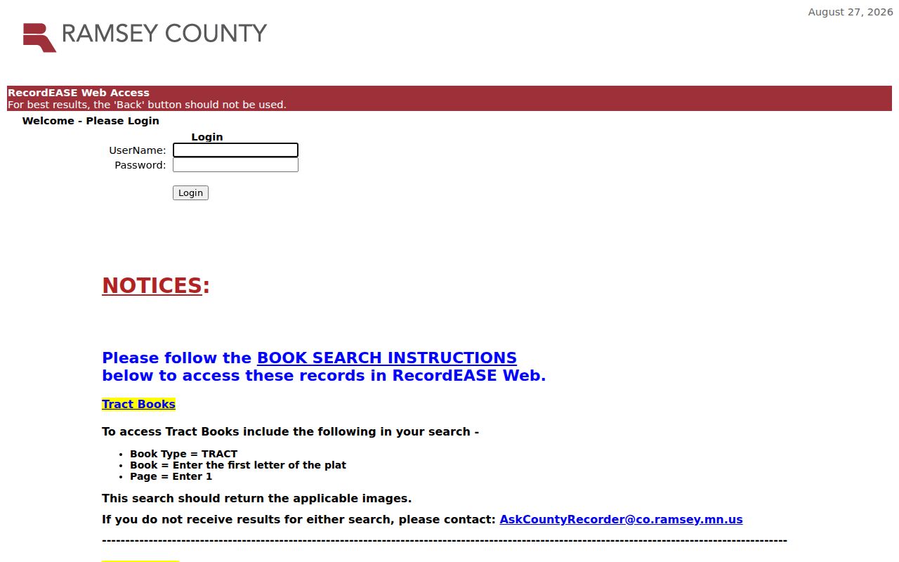
RecordEASE requires an account. The researched fee schedule lists a $25 monthly account charge, $0.85 for a document or certificate search, and $1 for a viewed document, certificate, or plat. The online search shows Book Type, Book number, and Page for book work. Index-book scans are grouped in 25-page PDFs whose starting page ends in 1 or 6, such as 001 or 026. For modern parcel research, save the document number, document name, recorded date and time, title-transfer marker, grantor, grantee, references, and legal description.
The RecordEASE login and book-search instructions appear in this source image. They show why a document trail needs more than a street name when a book or tract search is required.
If the web index does not resolve the document, use the Property Records Resource Center as the county counter fallback. Bring the document number, book and page, PIN, or legal description. Ramsey's official material does not publish one simple online grantor-grantee cutoff year, so do not assume that a missing web result means the deed never existed.
White Bear Lake Title Transfers
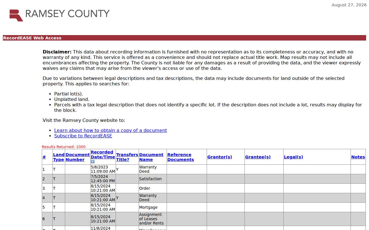
A deed shows that title moved. It does not prove that the grantor or grantee occupied the property. Start with the newest title-transfer document and read its parties as a record of the transfer. The newer deed's grantor is often the earlier owner to search as a grantee in the prior purchase. Repeat that move only when the legal description and parcel context still agree. Partial lots, unplatted land, and block-level descriptions can return extra documents, a limitation RecordEASE itself flags for legal-description results.
This sample RecordEASE legal-description result shows the kinds of document columns that support the check: document type, recorded date, title-transfer indicator, parties, references, and legal description. Treat it as a search aid, then open the matching record or ask the Resource Center for the appropriate copy.
The land type matters. A Torrens result may require a certificate-of-title or Examiner of Titles route, while an Abstract chain relies on recorded instruments. Mixed documents can require separate submissions and fees, so use the land type field before assuming one chain covers all records.
White Bear Lake Address History
Street research in White Bear Lake can fail even when the number is correct. Washington Avenue was once Railroad Avenue. The White Bear Lake Area Historical Society also publishes 1980s building-renumbering spreadsheets in both old-address and new-address order. Use that cross-reference before concluding that a historical directory, newspaper notice, deed, or permit does not belong to the modern parcel. Preserve the original spelling, prefix, suffix, and unit as you test each version.
The city, village, township, and neighboring-community labels also changed over time. White Bear Township organized in 1858; the Village of White Bear existed from 1881 to 1921; the City of White Bear Lake followed in 1921. A historical record may be filed under White Bear Township, Village of White Bear, White Bear Lake, Birchwood, Dellwood, or another nearby unit. That jurisdiction shift is a records clue, not proof that the place was outside the modern city.
Note: Match an old address to its cross-reference and legal parcel before merging it with a modern street directory result.
White Bear Lake Permit Dates
White Bear Lake ePermit adds a dated property-history layer. The city makes permit and inspection history available from 1988 for White Bear Lake properties. Older permits and plans, reaching back from 1992, are archived at City Hall. A permit can help date construction, remodeling, or an inspection event. It can include an address, permit type, applicant, contractor, owner, or result field, but those fields are not a residency list.
For a record that does not appear online, ask City Hall or Community Development for the address and date range, and state whether inspection or copies are wanted. Ramsey's Minnesota Government Data Practices Act route is another option for county public data. A request should name the records sought and say whether inspection or copies are preferred. Ramsey says inspection is free, copy charges may apply, and a requester need not state a reason or identify themselves for public data.
White Bear Lake Voter Route
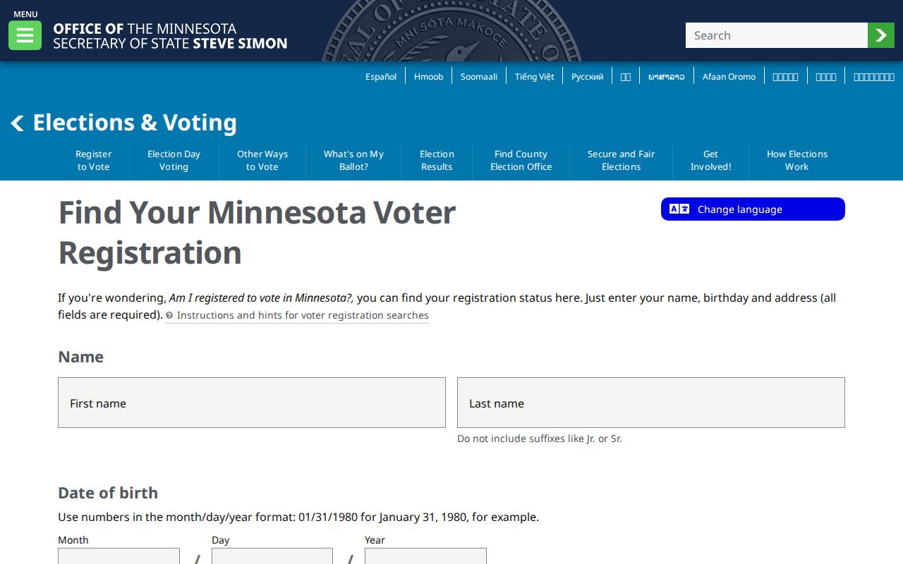
Find Your Minnesota Voter Registration requires a name, birth date, and address. It confirms a supplied registration and is not a public street roster. The form can use ZIP or county and then city or township, house number, street, and unit information. It is useful only for its limited confirmation purpose, and the state says the data update nightly.
The lawful street-sorted path is a different product. Minnesota's voter walking list is sorted by street name and number, costs $30 for a local report, and is available only to a registered Minnesota voter subject to the permitted-use restrictions in Minn. Stat. §201.091. Protected and Safe at Home records are withheld. A walking list may contain name, address, phone, birth year, and abbreviated recent election history, but it omits other voter identifiers. Requesters must use the Secretary of State's form and certification.
The MNVotes confirmation form shown here illustrates the identity and address fields required before a result can be checked.
Use the confirmation form and a walking-list order for their separate legal purposes. Neither should be treated as proof that every person at an address is known.
White Bear Lake Street Coverage
Several White Bear Lake records can be reached by address, but each covers a different role and time period. The table keeps the current street directory chain focused on the record's actual use instead of implying that one source supplies a complete resident list.
| Address record | Street use | What it can show | Access limit |
|---|---|---|---|
| Beacon parcel roll | Select a numbered parcel | Owner, mailing, site, classification, value, PIN | Owner is not every occupant. |
| MapRamsey | Click a parcel and nearby polygons | Geometry, displayed fields, imagery, boundary context | Not a survey or title determination. |
| RecordEASE | Search legal description or land record | Transfers, parties, documents, plats, references | Account and viewing fees apply. |
| White Bear Lake ePermit | Search the property history | Permit and inspection chronology from 1988 | Older material is at City Hall. |
| SOS walking list | Street-sorted registered-voter report | Limited voter-list fields | Requester and use are restricted. |
| WBLAHS material | Test historic address forms | Old-new number bridge, newspapers, plats, directories | Some work needs appointment or staff help. |
A USPS city label is another useful check, but not evidence that a person or company is at an address. The White Bear Lake Post Office uses a Saint Paul mailing line, and ZIP boundaries cross municipal lines. Keep the parcel's site city and county with the postal result.
White Bear Lake Address Archives
For a past household question, the White Bear Lake Area Historical Society offers the strongest local bridge: an online genealogical newspaper index for 1887 through 1988, local newspaper microfilm from 1887 through 2005, census spreadsheets for 1860 through 1930, historic plats, council minutes, cemetery indexes, church records, and photographs. The Society's online collection is moving to MNCollections, and not every image is cataloged. A missing catalog result is therefore not proof that the physical material is absent.
Historical reverse directories can turn a number into a dated name when the volume has a criss-cross section, but the exact White Bear Lake-only directory run is not published in the public catalog text. Check the historical society or Minnesota Historical Society for St. Paul North Suburban and Ramsey volumes, then pair an address result with the old-new number index. The historical shelf is described in more depth on the White Bear Lake City Directory page.
For a local story tied to a parcel, pair the directory or newspaper date with a deed, permit, and plat. That combination distinguishes a property record from a household reference.
White Bear Lake Street Limits
A street directory cannot show non-owner household members who have no public record, private utility or delivery accounts, protected voter information, private court party addresses, or nonpublic licensing and application data. DMV address data is also restricted. A property owner, a permit applicant, a voter, a business contact, and a historical directory occupant are separate roles. A match in one field should not be rewritten as a claim about all people at the property.
When a county record is unclear, ask the custodian for the field definition, record date, and applicable access rule. Minnesota's Government Data Practices Act presumes government data are public unless a law classifies them otherwise, but that presumption does not open protected information.